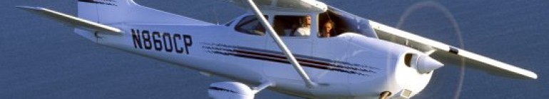
Today Mac and I flew up to the vicinity of Long Beach, and then headed back. I had wanted to get a feel for figuring out the flight plan, and also for checking in with Departure and Approach. It didn’t quite work out that way though.
For starters, although Mac had shown me once before how to fill out a navigation plan, I had pretty much forgotten and so we spent an hour beforehand just doing that. The problem was, Mac’s been doing navigation electronically for so long that he was lousy at using the E-6B, which is an aviator’s version of a slide rule. So after an hour we pretty much scrapped that idea and decided to fly electronically.
In one sense this was disappointing because after we had passed Mount Soledad, I just put it on autopilot for almost the entire flight. And then the problem was that I had not done a whole lot of electronic navigation before, and so really didn’t understand a lot of what Mac was trying to tell me.
The key point I was supposed to be attending to was that wind was affecting both speed and direction.
If I had been doing it by hand I would have been manually timing each leg and then dividing distance by time (using my E-6B) to get speed. This — in theory — would have helped with fuel calculations (more on that in a minute).
And I would have been computing offsets in heading to account for the wind.
But again, all this was pretty much done electronically, and since I don’t fully understand all of the navigation instruments, much of it went over my head.
The good news about that, though, was that I got to pay a bit more attention to some of the finer points of higher altitude flying (we were at 6,500 feet on the way up, and 5,500 feet on the way back).
For example, when you check the winds aloft before you take off, you might see that the winds at 3,000 feet are significantly different from the winds at 6,000 feet. And because of that difference (depending on how significant it is), you can probably anticipate turbulence at the point where the change occurs. The only problem is that you don’t know where, exactly, that change occurs.
In our case, since we were at 6,500 feet, we were looking at the region between 6,000 and 9,000 feet. And somewhere in there, there were some big difference in both direction and speed. So when we hit some turbulence, we had been anticipating the possibility.
Also, we had the autopilot set for 6,500 feet at 120 knots. But every once in a while we would hit an updraft or downdraft, and the plane would do what it needed to stay at our present altitude. If we hit an updraft, the plane would lower the nose, thereby increasing the speed. And vice versa when we hit a downdraft. It was subtle, but in those cases I had to manually adjust the power to compensate.
One cool thing Mac pointed out was a little military ramp that some pilot had used once when his engine had failed. This led to a broader discussion about engines failing. I asked Mac why we hear about airplane engines failing in flight, but you never hear about car engines suddenly dying on the highway. Mac said two things in reply.
First, car engines are generally made with current technology, whereas many airplane engines are made with 1930s technology. Gulp! That sure didn’t make me feel good. But he also said that some huge percentage of airplane engine failures — like 85% — were a result of running out of gas. I was like…huh? People actually run out of gas while they’re flying? And that made me feel much better, since that is so controllable.
Anyway, all in all a good flight. This is the route we flew (outbound in blue; inbound in red). If you switch to satellite view and zoom in, you can see the little ramp that plane landed on. It’s marked with the blue icon.
So Friday we are flying to Long Beach for sure, and Thursday afternoon I have a class with John on how to use the E-6B to do manual navigation.
